Shirley Chisholm State Park
(I'm back after some time off. See note at the bottom of the page.)
A year ago, I heard about Shirley Chisholm State Park. So I drove out there to take a look, and walk the trails. Not all of them were open yet, but what was was worth the trip.

Pictured: Shirley Chisholm painted on the side of a building when you first enter the park. For those who are unaware, she was the first black U.S. Congresswomen, and a representative from Brooklyn, first elected in 1968.
Ironically, a year later, thanks to unforeseen circumstances, combined with job placements, it remains the only part of eastern Brooklyn I've had the chance to walk in the past year. (Before that, I been assigned to a couple of locations in East New York. I've walked a good part of Pennsylvania Avenue, from Linden Blvd to the A train, and the area around Spring Creek, from the mall to the New Lots Avenue station.)
The first thing I noticed was on the exit to the Belt -- suddenly you could make a right turn where one hadn't existed before.
As can be seen on the map (below), most of the trails were not completed yet when I visited. Only the smaller portion on the right side of Hendrix Creek was open. There was a foot trail connecting them along the Belt Parkway. However, I didn't walk it because I would have had to just turn around at some point and walk back to my car. (Note that the map faces South.)

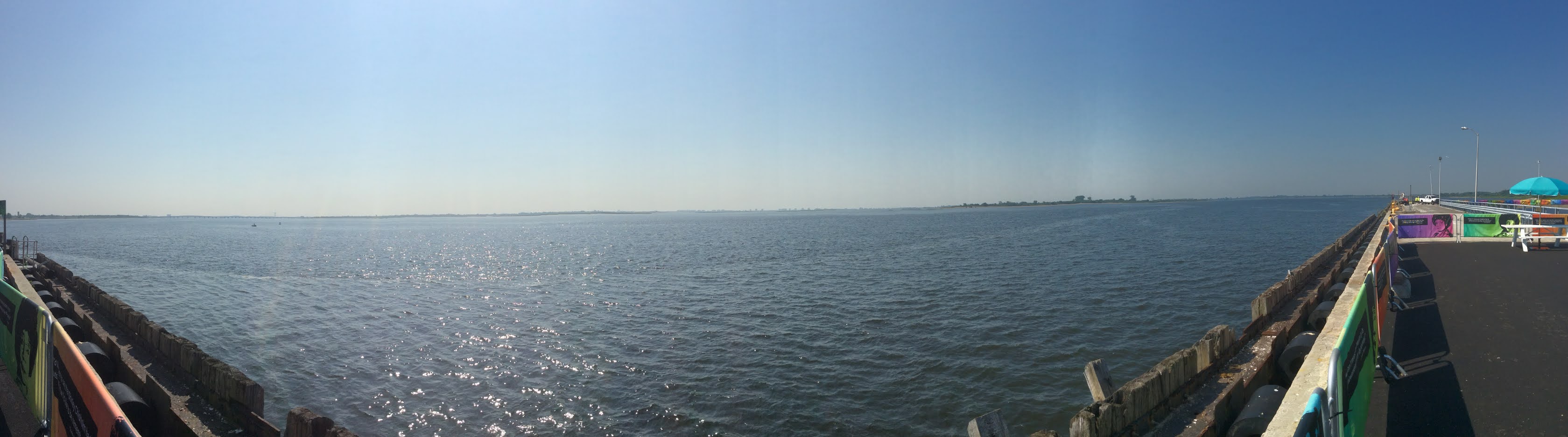
It was a hot morning, and I was fully exposed, but I walked all the available trails, and down the pier, where fishing is allowed. One pier was closed off to the public. The best part was taking panoramic pictures. From the highest point, you could see the Verrazano Bridge and lower Manhattan. On a clearer, less hazy day, you could probably see the Empire State Building -- from the southern shore of Brooklyn!
I'll have to go back when the pandemic is over, and the other trails are open. Preferably when the temperature isn't higher than the 70s.


Special Note:
The reason I took some time off was because I had to work on the edits for my first flash fiction anthology, which has now been published by eSpec Books as both an ebook and a paperback.
In A Flash 2020, by Christopher J. Burke is not available from Amazon.
![In a Flash 2020 by [Christopher J. Burke]](https://m.media-amazon.com/images/I/51+4JVxWDxL.jpg)


Comments
Post a Comment