Kings Highway (E 98 Street - Nostrand)
For all the times I driven along Kings Highway -- and my old Garmin GPS loved sending me down the entire length of Kings Highway! -- I would've thought the walk should've been longer. Perhaps because I only had to walk as far as Nostrand to complete the street.
Kings Highway was a street that I had no idea when I was ever going to complete mostly because I looked at the map from West to East and contemplated how would I get back home? Would I would or grab a bus?
But after my first trips to Brownsville and seeing the start of the road (or what used to be the *end* of the road when I worked inside Boys and Girls High School at Research and Service HS), the thought of walking it home from this point crossed my mind. And having walked from East New York to Prospect Lefferts Gardens a couple times already made this trip inevitable.
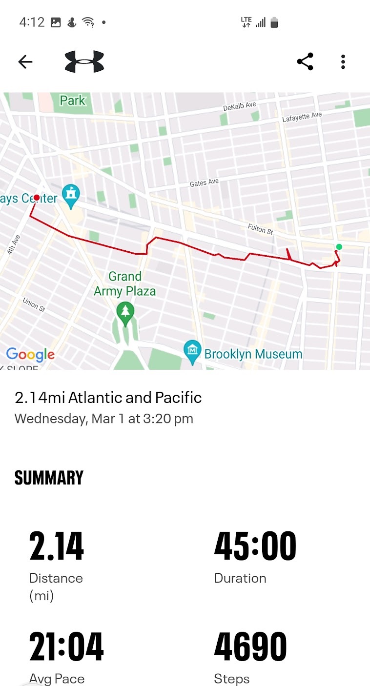
And I stated before, I couldn't believe how quickly I finished it, even if I did walk over 4 miles.
The walk started at Saratoga Ave. Since I'd already walked Livonia Ave, I walked up a block to Dumont Ave, which intersect Tapscott St, which becomes Howard Ave to the north and Kings Highway to the south. (There's also a supermarket there when I stop for to buy a roll for the walk.)
Kings Highway starts at E 98 Street, which is a boundary or sorts. There is a neighborhood that is 8 blocks wide that pushes its way into other neighborhoods like a feeder dike in Geology class. In fact, different maps will call this area Brownsville, East Flatbush or even Remsen Village.
A block away is Rockaway Parkway, which you might think would be a major boundary, neighborhood changer. It's a major intersection, to be sure, with Clarkson Ave forming a little triangle of concrete.


Next up is one of the craziest intersections that I have crossed in all of Brooklyn. More than a point of concurrence, more of a point of confluence of mighty roads (instead of waterways). Kings Highway crossing Linden Blvd would be epic enough without Remsem Ave going through (not near but through) the same intesection. As an added bonus, Wilmohr Street terminates at Linden Blvd a little shy but it's traffic is shunted onto Kings Highway. And, finally, E59 Street branches out of Kings Highway. Looking at a map, you can see how they diverted E59 Street away from that intersection!
The grass on the side of the road was worth a picture, as was one of the triangles of land where a southbound street splits off. I believe that this was E56 Street, which starts below Tilden Ave. There's a tiny street there but it doesn't have a name. I think it only exists for drivers on E 56 St to make left turns onto Kings Highway.
Another interesting-looking (to me, anyway) house with a tower across the way.


At Clarendon Road, E 55 Street breaks off and heads south. Slightly past that is a tiny sliver of street without a street sign. According to Google Maps, both houses have Kings Highway addresses. In any case, I did walk its length and back again.
A couple blocks later were Jodie Court, which was a dead end, and Whitty Lane, which runs to E 56th Street, and could wait for a future walk.


Getting to the elevated tracks so quickly surprised me. I remember this as a choke point of sorts while driving, but I didn't remember exactly where in the drive it was. These are tracks that they want to use for the IBX rail system to connect Brooklyn and Queens. In this section of Brooklyn, those tracks divide neighborhoods and cause streets to dead end. In this immediate area, only Kings Highway and Utica Ave cross the tracks. To the east, you have to go back to Ralph Ave to get past the tracks.
Once past the tracks, E53 St splits off. A block later, Foster Ave goes northeast away from Kings Highway on my left side, which is funny because I passed Foster Ave on my right two blocks back! The crazy streets of Brooklyn.


Kings Highway actually turns north-south for a couple of blocks, basically replacing E 45 Street from Ave I to almost Ave K, before heading southwest again. At E 40 St, I passed the Flatlands Reformed Church. I hope to get more pictures when I go down that block.
Ave M brings the traffic circle around Fraser Square Park. And a few blocks later, I'm at the Nostrand Ave bus stop, and Kings Highway is officially completed on my map!


And that's it for this trip. Come back soon. I'm almost up to AUGUST! I hope to get there before November!
MY NEWEST BOOK IS AVAILABLE NOW!Burke's Lore Briefs: Yesterday's Villains, the following to Tomorrow's Heroes is now available on Amazon and Kindle Unlimited. If Heroes who don't die live long enough to become the villain, what happens to Villains who live long enough? When do schemes of global conquest become dreams of a quiet place away from all those annoying people you once wanted to subjugate? And does anyone really want to rule over the world's ashes if it means we can't have nice things? |  |
 |
|
My older books include three more books in my Burke's Lore Briefs series, and the anthologies A Bucket Full of Moonlight and In A Flash 2020. Vampires, werewolves, angels, demons, used-car salesmen, fairies, superheroes, space and time travel, and little gray aliens talking to rock creatures and living plants. Plus pirates, spies, horror, and kindergarten noir! If you enjoy my books, please consider leaving a rating or review on Amazon or on Good Reads. Thank you! |
 |
 |

|
 |
 |


Comments
Post a Comment