Posts

Kings Place

Image
Kings Highway runs about 6 miles from Bensonhurst , through Flathland s, East Flatbush and ending in Brownsville just before making connections with either Empire Blvd or Eastern Parkway . It originally extended farther down into Bay Ridge. In fact, there's a park named Milestone Park  on 18th Avenue , with a replica of the original milestone marker that used to stand there. Not far from its current endpoint, a few blocks from McDonald Ave , I came across a short dead-end block labeled Kings Place . I'm trying something new. I sketched my own map so I wouldn't have to use one from either Google or Apple.  The West streets count down north of Kings Highway, but below it, they temporarily stop at West 3rd . Kings Place isn't parallel to the West streets. Instead, it runs parallel to neighboring Van Sicklen St and Lake St , as well as McDonald Ave, which bends at this point. (North of Kings Highway, McDonald is parallel to the West streets and the East streets on the ...
Bush Terminal Park

Image
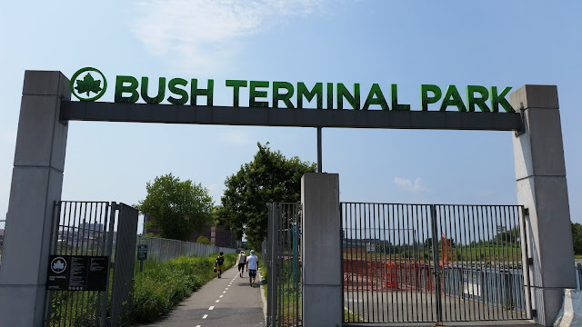
Later in the day, after I'd gone to the  Brooklyn Army Terminal , someone online asked me if I went to  Bush Terminal Park . To which I responded, "What?" Apparently, I had walked past another entrance to the Brooklyn waterfront and hadn't noticed it. In retrospect, mind you, I actually did notice an entrance. I just didn't think it was a public entrance to a public park. Let me start by saying that this first picture was one of the last ones I took. This entrance is not visible from First Avenue . It's off the beaten path. Since I was coming from the higher-numbered streets, I saw this, which I assume is the "back entrance", first. I have driven into this parking lot many times (there was a store there I used to go to, but I'm not legally allowed to talk about anymore). I never saw this sign and never knew that there was a road open to the public here.  Interestingly, Google Maps shows the 50th Street continues below 1st Avenue and then...

Spotted on Cropsey Ave

Image
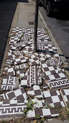
Spotted on Cropsey Ave . Not every takes the time to tile their trees so nicely. taken on May 26, 2020

Six Miles Before Breakfast: Featuring Old New Utrecht, Microscopic Dahill and the Bay Ridge Branch

Image
One day last week, I was up early enough that I had time to go for a walk before work when it was still cooler outside, and when there'd be fewer people about. I hadn't planned on the trip being over six miles long, but that's how it turned out. In the past, I've walked Bay Parkway , 20th Avenue and 18th Avenue all the way to McDonald Ave . The goal this time was to take 19th Avenue to its end, cut through the Shop-Rite parking lot, stroll down McDonald Ave, and pick up 17th Avenue for the walk home. I had a couple of detours along the way. Plus, I have difficulty reading my phone outside between its dimness and my polarized glasses. I went a little out of my way in trying to find 17th Ave, which doesn't cut all the way through. Some highlights from the trip, as mentioned in the blog title: New Utrecht Ave is a street that runs diagonally across the grid from 9th Avenue and 39th Street down to 86th Street between 18th and 19th Avenues . N...

Little Orphan Avenues: Ave Y and Ave Z in Bath Beach

Image
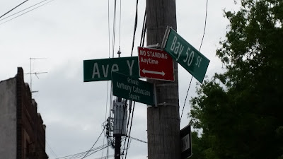
On a recent trip, I went to fix out some of the last streets I need to walk in Bath Beach , which runs south to Bay 50th Street . I don't know where the boundary would or should be. At this point, below Bay 50th, I wasn't in Coney Island yet, so the only other thing you might call it is Gravesend . The streets align with Gravesend, but the train yard slices these streets away from the rest. Basically, a bunch of streets and avenues are orphaned, cut off from the rest of their kind. In short, my trip took me up and down one Bay street, four West streets (plus part of Stillwell Ave), two lettered avenues, a piece of Shore Parkway , and a short "place". I found that a couple streets listed on Google Maps do not exist, or they are private roads, even if they have names.  The creepiest street, even in the middle of the day, was West 13th Street . It extends for one block in either direction from Ave Z, ending in Dead Ends in each direct...

Brooklyn Army Terminal and First Avenue

Image
Last year, for some reason, I got a lot of sponsored ads on Facebook for the Brooklyn Army Terminal . So I took a trip down there. Disappointing. There was nothing there, except the pier for the ferry and the view of the harbor, but there are other places to view the harbor, which are closer to the Statue of Liberty . There are also a bunch of blank, stark buildings down there. If there's anything in them, I saw no signage, and I wasn't going to snoop around uninvited at some place called an "Army Terminal". Maybe I missed out. More interesting was the walk I took down the entire length of First Avenue . In hindsight, I wish I'd taken more pictures. First Avenue looks like something that hasn't moved out of the Post-war era. It's "riverfront" property that's overdue for a make-over and facelift. It's a prime spot for development and over-development. And when that finally happens, it will be a sad thing. The only sa...