Posts

Back to Bay Ridge

Image
I got the early service for Ash Wednesday , and I then found myself near the B4 bus line with a bus approaching. I took the opportunity to ride down to Bay Ridge. (Or is it up? Or over?) And from there, I filled in a little more of my Walkin' Brooklyn map. In particular, all the numbered streets from 84th down to 75th (Bay Ridge Parkway), from Ridge Blvd to Third Avenue, which the exception of 75th steet where I needed the 3rd-4th Ave block as well. Once again, the above screenshot was taken from the Map My Walk app. I don't get paid for mentioning it, but the Under Armour logo is in the shot, so I should acknowledge it. It was a pretty straightforward walk, with a lot of downhill and then uphill. No side streets and nothing out of the ordinary, except it was a little chilly. That in itself isn't odd for February, but it was odd for this February. Nevertheless, I did take a few pictures of a few homes. This first...
Sheepshead Bay, Part 2 of 3

Image
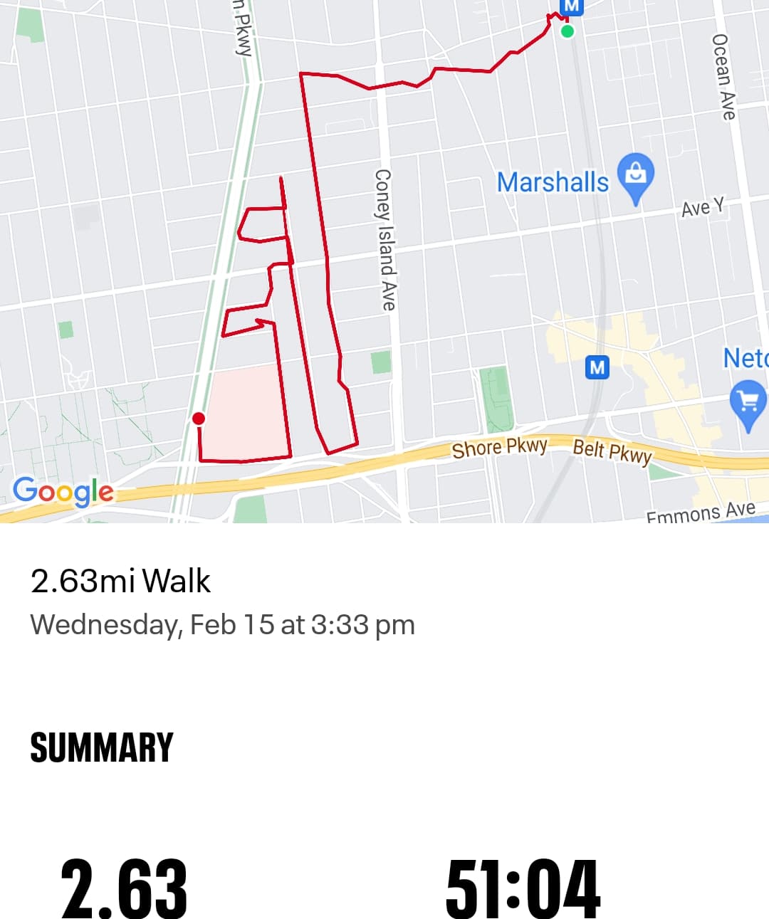
Part 2 of filling in this section of Sheepshead Bay starts at a different train station. I got off at Gravesend-Neck Rd, which will branch off from what will turn into Ave W. As you can see, "Map My Walk" had a little heart attack with their satellites -- one of the drawbacks to using their maps. I don't know if other apps experience the same problems. It's generally good when I'm walk straight lines, but when I walk up and down streets, it occasionally has me walking through the middle of private homes. No trespassing occured on this walk. As per the map, this walk took place on February 15, 2023. Starting on Neck Rd and Ave W, I walked down E7 St, up Hubbard St, and down E6 St, to the hospital bus stop. And, of course, there were several tiny courts along the way. I almost circled through a parking lane that opened on two different blocks, but a young woman was walking a big dog, and I thought better of it. ...

Sheepshead Bay, part 1 of 3

Image
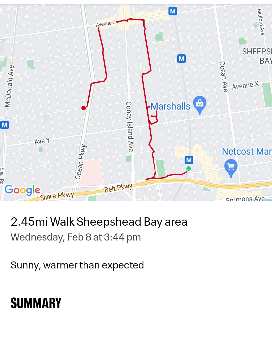
This is my first of three trips to finish off the streets between Ocean Parkway, the Belt, and the B/Q Brighton Line in Sheepshead Bay. The south side of the Belt will come later. There are a lot of small streets, so there will be a bit of overlap and backtracking. I even confused where Ave W and Ave X where on the map, and where the bus routes were. Lots of photos The first detour off E12 Street was onto Desmond Ct, which is a short block that leads into a piece of Homecrest Ave.       This part of Homecrest Ave that's isolated from the other parts. There are three sections of Homecrest Ave between Ave S and the Belt Parkway.       After making it to the avenue, I doubled back to Doone Ct. and onto E12 Street again to continue my journey.     ...

Prospect Ave, Beverly Road, E 9 Street

Image
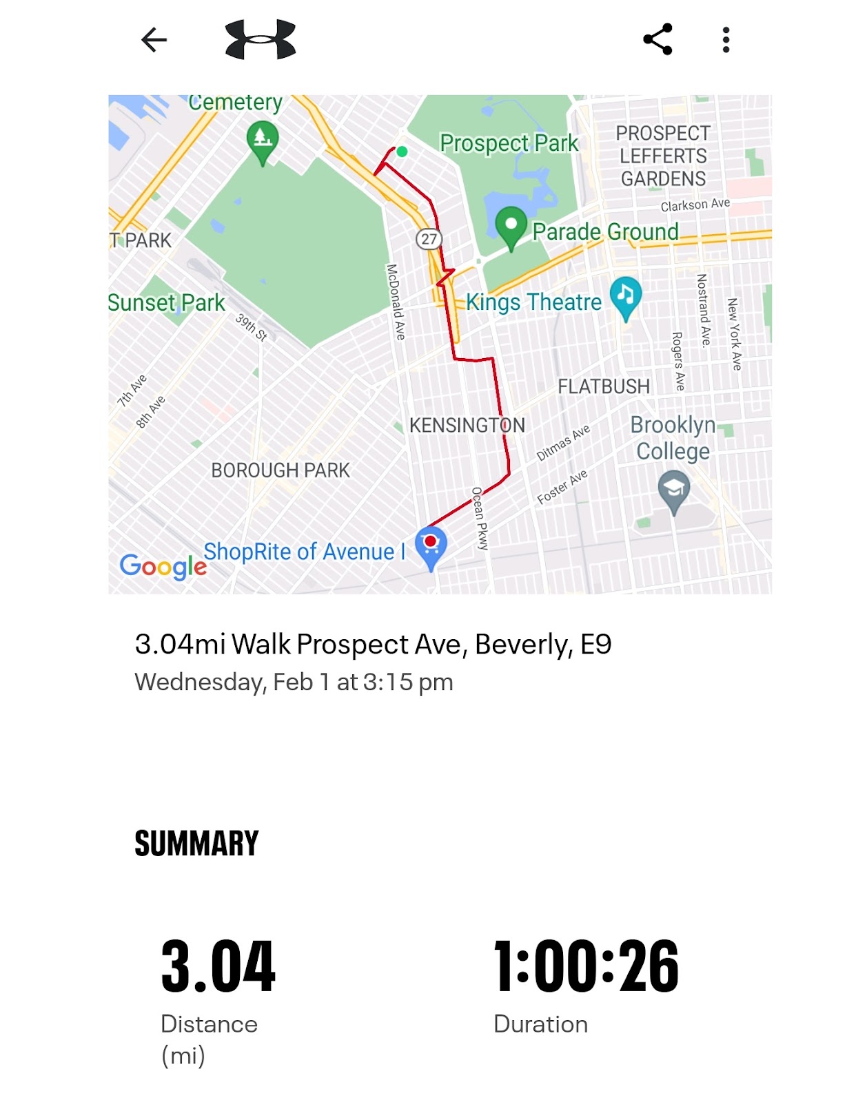
So this was my walk on February 2, which for some reason, I never posted. I walked through Windsor Terrace/Kensington, or whatever this area is called. I have some streets between the Park and the Cemetery to finish up, along with the East streets up 18th Ave. The picture below shows an overpass, but it isn't a highway. It's Seeley Street, those are parked cars up there. I remember this from when I was a kid, as my father had a friend who lived down that block. When you got to the corner there were steps to go down. I didn't remember that it was Prospect Ave, but that's what it is. It curious that this one drop doesn't have a hill and drop down but instead continues at the same altitude. It does intersect with 18th Street and then crosses the expressway. I hung a left onto Beverly Road to get to E9 Street. Watch out for low branches. Okay the angle makes it look worse than it was, but I could've clonked my noggin someth...

Ave N and Kings Highway

Image
I haven't updated this blog in quite a while. Partly it was because I was taking a lot of pictures on my phone and they're a pain to transfer. And partly because there are other blogs doing the same thing that are probably more entertaining or have more information. For any newcomers, I'm a walker. My father had me and my borther walking all of this city from an early age. I take a lot of walks, particularly in the summer (I'm a teacher), and I got tired of walking the same curcuit about my neighborhood, so started branching out. In May 2019, I started tracking where I was walking. Then the pandemic hit, and I found myself with a lot more time to walk. I'm still walking. On Monday, January 30, 2023, I walked a section of Ave O that I hadn't walked already. Then I walked a bit up Kings Highway until I reached Ave N. At that intersection, there's a small triangle of land, created along with E31 Street. I have thought about the idea of doc...

Walkin' In Canarsie

Image
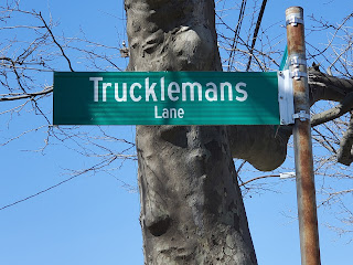
It's been some time since I've been in Canarsie. I haven't been assigned to any schools in the area, but I have driven along Rockaway Parkway, which can be extremely frustrating. Yesterday, I had to give someone a lift to Canarsie High School to get a vaccination. Since parking was easy to find, and I had at least a half hour to wait, I decided to take a short walk around the neighborhood. My pics of the high school didn't come out due to a combination of new phone, bright sun, polarized glasses, and user error, heavy on that last one. The school takes up two full city blocks, from Avenue J to K, and from E 95 Street to Rockaway Parkway (which would be E 97 Street). The first stop of note was a sign on a tree for Truckleman's Lane , which looking left and right on either side of the parkway, I did not see. I saw what looked like driveways or backyards. A Google search tells me that the lane does in fact exist and curves, so I wouldn't have seen the other...

Shirley Chisholm State Park

Image
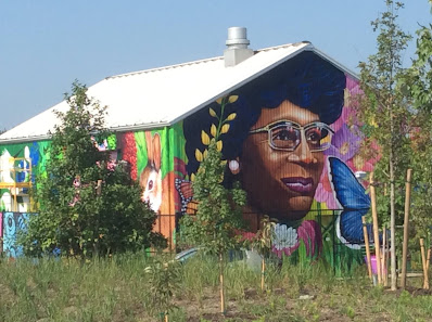
(I'm back after some time off. See note at the bottom of the page.) A year ago, I heard about Shirley Chisholm State Park . So I drove out there to take a look, and walk the trails. Not all of them were open yet, but what was was worth the trip. Pictured:  Shirley Chisholm  painted on the side of a building when you first enter the park. For those who are unaware, she was the first black U.S. Congresswomen, and a representative from Brooklyn, first elected in 1968. Ironically, a year later, thanks to unforeseen circumstances, combined with job placements, it remains the only part of eastern Brooklyn I've had the chance to walk in the past year. (Before that, I been assigned to a couple of locations in East New York. I've walked a good part of Pennsylvania Avenue, from Linden Blvd to the A train, and the area around Spring Creek, from the mall to the New Lots Avenue station.) The first thing I noticed was on the exit to the Belt -- suddenly you could m...